Overview
Annapurna Circuit Trek in the Annapurna region of Nepal is the longest and one of the most diverse treks in the world. Walking the distance of 128miles through four districts (Lamjung, Manang, Mustang and Myagdi) and two zones (Dhaulagiri an Gandaki) allows you to encircle Annapurna massif along with Dhaulagiri, Nilgiri, Langtang Himal, Manaslu, Machhapuchhre, Gangapurna, and Tilicho Peak.
However, Annapurna Circuit trekking route isn’t just perfect for the dramatic views of lofty mountains but is also the best in terms of the diversity in climate (Tropic-600m to Arctic-5,416m), altitude (deepest gorge to the high pass – 5,400m), landscape (tropical forest featuring rare species of plants and animals, terminal moraine, snow line and barren land), trail (steep, narrow, icy, windy and dusty) religion (Hinduism, Buddhism, Bonpo and Tibetan Buddhism), pristine little settlements (Thini, Lurpa, and Nargon) and culturally prosperous tribal groups (Gurung, Thakali and Manangi); their culture, tradition, festival, food, dance and dialect.
Some of the major highlights of this trek around Annapurna are two river valleys (Gandaki & Marshyangdi), Thorung La pass (5,400m), Hindu and Buddhist holy site (Muktinath Temple), amazing fire-flame produced by natural gas from soil, water and rock (Jwala Mai Temple) and one of the oldest monasteries in the Annapurna region (Braga). Trekking, Annapurna circuit is another superb opportunity to enjoy two contradictory
baths – one is a sacred bath in water pouring through 108 bull-faced taps and a dip in chilling water in the Kunds (Saraswati and Laxmi) in the premises of Muktinath and the other one is a muscle relaxing bath in hot springs (Chame and Tatopani) en route. Moreover, you can also enjoy the early morning view of sunrise in the Himalayas (from Poon Hill).
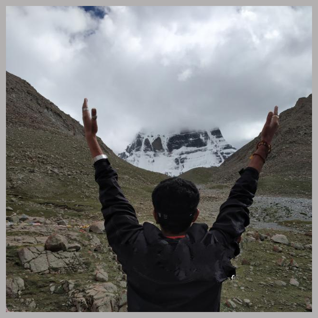
This round Annapurna trek will definitely prove to be one of the rarest adventure experiences in your life.
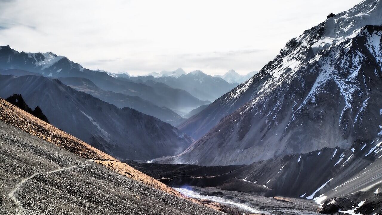
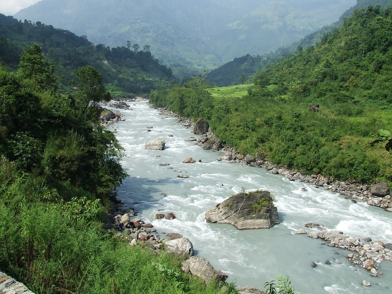
Tilicho Lake Trekking route attaches with Annapurna circuit route which is one of the world’s most popular trekking routes starts from Chamje from where you follow the trails of Marsayangdi River leading to the villages of Tal, Dharapani, Chame, Pisang, Manang, Khangsar and finally Tilicho Lake. With every new destination, the climate and landscape are bound to change. The trail then takes to the tranquil Tilicho Lake sitting peacefully amid bare hills behind which the snowy peaks glitter.
Day to Day Itinerary:
Day 1 : Arrival at Kathmandu Hotel
We will Pick up our Clients from Airport according to the Flight schedule and drop to the Hotel in Kathmandu
Day 2: Drive to Besi Sahar and (823m) (Around 7 hrs’ drive ) and Take Jeep to Dharapani (1900 mtr) (3 Hr )
Drive to Besi Sahar covering about 173 kilometers or so from Kathmandu to Besi Sahar, and take jeep to Dharapani . Drive duration: (10 Hrs )
Day 3: Trek to Chame (2,713m)( 15.5 Km ) ( 5 Hrs Trek )
It takes 45 minutes to reach the village of Bagarchap (2164m), which literally means ‘the river bank’. Bagarchap marks the barrier between the humid valleys of the south, which is to be crossed on the way, and dry regions of the high- Marsysngdi. That the monsoon is more or less absent in this region is evident by the change in vegetation.
From Bagarchap, it will take an hour to climb up to the hamlet of Dhanagya (2300m), lunch spot. After lunch it takes us about 2-½ hrs to 3 hrs through the hamlet of Thanchock and Besi Salla (which means “the Garden of Pines”) to reach Kodo (and also called Koto) meaning ‘Millet’ and then to the village of Kyupar (2600m). Outside the village a police check post controls the access to the Nar Phu Khola Valley, which leads to Tibet. Chame, the headquarter of Manang District, is forty five minutes walk away.
Day 4: Trek to Pisang (3,185m)( 15 Km ) ( 5 Hr trek )
After reaching the school at Chame, move to cross the bridge to get to the northern bank of Marsyangdi. Walk along the river to reach the village of Bratang (2919m), mainly populated by Tibetans. Stop for Lunch. On the way to Bratang, pass through a splendid pine forest with splendid views of Lamjung and Annapurna II and IV.
After lunch it’s about two hours walk to reach the top, where trekkers traditionally plant a pine sapling, not only to establish that they have made it to the top, but also to contribute to the reforestation of the area. Go down to Pisang (3185m) from here and it takes about an hour to reach there. There are neither houses nor any water resources on the way down.
Day 5: Trek to Manang (3,530m) ( 15.7 Km ) ( 6 Hr )
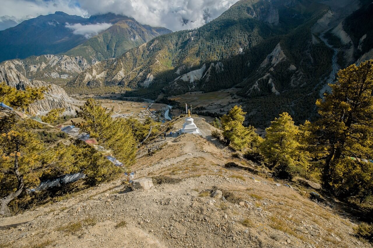
After crossing the Pisang Khola there is a forty-five minutes steep climb up to a steep pass. From the top of the pass, get a glimpse of Paunda Danda (4655m), Mount Pisang and Manang valley, with Mount Tilicho in front. On the way down to Hongde come across a check post where the trekking permits will be rechecked. Lunch at Hongde. After Hongde, the valley widens with the Annapurnas III and IV (7555m and 7525m) to the left, East and West Chulus(6584m and 6419m) on the right, towards the horizon, there are views of peaks of Mount Thoroung(6481m) and to the east, the crown of Mount Pissang. From Hongde, climb up to the ancient village of Braga (3505m).
Have leisurely time to wander around Braga to see this picturesque village with its flat roofed houses and to visit Gompa, not only the largest in the region but also the richest with its fine collection of thangkas (religious scroll paintings) and prayer books. It takes only forty-five minutes to reach Manang from here, which sits on the plateau of 3530 meters.
Day 6: Rest day at Manang
Take an extra day to rest and acclimatize before proceeding to higher altitudes. Optional walk in the afternoon to the north of the village, which offers a panoramic view of Annapurna II and IV to the southeast and Gangapurna (7455m) and Tarke Kang or Ice Dome (7202m) to the southwest.
Stay overnight at Manang
Day 7: Trek to Shreekharka (3,850 m) ( 14.5 Km ) ( 5 Hr )
The Khangsar trail goes downhill to a chorten, and then turns northwest and heads down towards the river. Stay on a north bank and head west, following a trail alongside the river. Follow the power lines along the ridge on a wide trail and then traverse along the south side of the ridge through a blue pine forest. Cross the suspension bridge and climb up the ridge.
Day 8: Trek to Tilicho Base Camp (4,950 m) ( 5 Hrs )
Beyond Khangsar and the Tilicho Base Camp, the trail climbs steeply to a small chorten, then climb more gently through juniper and sea buckthorn bushes to a crest at 3900 m. Traverse into a side valley, cross a stream and climb to some herders huts and a trail junction at 4050 m. The high trail to Tilicho Base Camp leads to the right, which is the safest route to Tilicho Tal.
Stay overnight at Tilicho Base Camp
Day 9: Trek to Tilicho Tal (4,920 m) & back track to Khangsar (5-6 Hr )( 13 Km)
The trail to Tilicho Tal starts up a valley. It. Then, traverses onto a moraine making a long climb to 4710 m. There are outstanding views of Khangsar Kang,
Tarke Kang, and Gangapurna as well as great views down the valley to Manang and Upper Pisang.
The trail then makes a series of steep switchbacks, climbing for an hour to a false summit and on to a crest at 5010 m. From here to the lake the trail is lined with hundreds of large stone slabs set on end. Passing two Lakes, the trail crest at a cairn and prayer flags where one will have their first view of the Lake (4920 m), 4 Km long and 2.5 Km wide. It is the lake situated at the highest place. After visiting Tilicho Lake, backtrack to Khangsar.
Stay overnight at Khangsar (4250 m)
Day 10: Trek to Churi Lattar ( 4250 m ) ( 4-5 Hr )
From Khangsar, the trail goes descending to Gungsang crossing Jharsang khola. The route passes through sparse forests of Juniper, rose and berry, a few meadows and Mani. Beyond is Yak Kharka, also known as Koche. Lunch at Yak Kharka and continue trek to Churi Lattar.
Day 11: Trek to Thorung Phedi (4,420m) ( 6 Km ) ( 3 Hr )
After leaving Churi Lattar the path climbs up till Thorung Phedi. These Himalayan pastures are domains of yak, a bovine of
Tibetan origin, reared for its wool, milk and to transportation of goods. The thar, a kind of wild goat that lives in herds, is also found here.
It takes about one hour to reach Thorung Phedi after lunch. Thorung Phedi means ‘foot of the hill’ and it is situated at a height of 4220m on a small hill overlooking a high plateau.
Stay overnight at Thorung Phedi
Day 12: Trek to Muktinath (3,802m) (16 Km ) ( 8-9 Hrs )
We have to cross about twenty hills on the way to reach the summit, Throungla Pass at 5,415 meters and it takes about 4 ½ -5 hrs to reach there. On the way up one sees many prayer flags several cairns (small mounds of rock). From the top one gets the views of the Yakgawa Kang or Thorungse (6481m) to the north, and Khatung Kang (6484) to the south and the Annapurnas along with the Gangapurna to the southeast. In the horizon to the west, Dhaulagiri (8169m) and Mount Tukuche (6920m) are also visible. From the summit the descent to Muktinath (3802m) takes about three hours and the difference in altitude is of 1600m.
Day 13: Trek to Marpha (2,667m)(19 KM) (7-8 Hrs )
After crossing the hamlet of Ranipauwa, adjacent to Mukntinath, one will reach the village of Jharkot (3612m), mainly populated by Tibetans. It takes about two hours through rocky terrain and horse caravans to reach Kagbeni (2807m). It will take about two
–three hours to reach Jomsom (2713m) from Kagbeni, the administrative headquarters of the region.
There is an airport with regular flights to Pokhara, a bank, post office, hospital and few hotels. One has to show our permits again before moving on to Syang (30 Min. away) and then to Marpha (2667m) our
camping place for the day. Marpha is famous for its apple liquor and it has a charm of its own with its black-salted streets and unusual architecture.
Day 14: Drive from Marpha to Pokhara in a Bus or Jeep ( 7 Hrs)
The jeep drive from Pokhara to Jomsom passes through beautiful hilly highways. We start from the gorgeous lake city of Pokhara. Before arriving at Tatopani, we will pass through various Dhikur Pokhari, Beni settlements, etc. The Pokhara to Jomsom by Jeep ride is a quick trip that takes around 6-7 hours maximum.
Day 15 : Fly from Pokhara to Kathmandu
We drive to the Airport and Fly from Pokhara to Kathmandu which is 25 min flight. After Flying to Kathmandu we will go to our Hotels in Kathmandu and take a Rest